GPS
GPS
Gps Reference stations
Also known as a conti- nuously Operating Refe- rence Station (CORS), this is typically a dual-frequency GPS receiver located at known coordinates, supplied with permanent power and connected to …
 GPS
GPS
Deformation monitoring
Navigation Gps Use GPS is now used in all aspects of navigation GPS voice navigation systems are standard with many models of car Simply typing the required destination into the unit results in a g…
 GPS
GPS
Machine guidance and control
Machine Guidance Earth moving is required to shape the ground prior to construction taking place In this context machine guidance is concerned with guiding the operator to move the blade or dozer.…
 GPS
GPS
locating position
topographic survey establishing control network and their subsequent computation leads t an implied rectangle coordi-nate system over the area surveyed , the minor control point in particular ca…
 GPS
GPS
Wide Area Augmentation System WAAS
Wide Area Augmentation System WAAS The US Federal Aviation Authority (FAA) is developing the Wide Area Augmentation System (WAAS) The WAAS is safety critical navigation system that improves the…
 GPS
GPS
GPS Observing Methods
The use of GPS for positioning to varying degrees of accuracy in situations ranging from dynamic ( navigation ) to static ( control networks ) has resulted in a wide variety of different field proced…
 GPS
GPS
Real time kinematic RTK
The previous methods that have been described all require post processing of the results However RTK provides the relative position to be determined instantaneously as the roving receiver occupies …
 GPS
GPS
GPS segments
GPS segments The GPS system can be broadly divided into three segments : the space segment the control segment and the user segment. The space segment is composed of satellites the constellation …
 GPS
GPS
Errors Sources
The final position of the survey station is influenced by : (1) The error in the range measurement (2) The satellite receiver geometry (3) The accuracy of the satellite ephemerides (4) The effec…
GPS
Multipath error
This is caused by the satellite signals being reflected off local surfaces such as buildings pr the ground resulting in a time delay and consequently a greater apparent range to the satellite ( Figu…
GPS
وحدة الهوائي في GPS
وحدة الهوائي الموجة الالكترومغناطيسية الواصلة من القمر الصناعي يحول طاقة الاشارة الي تيار كهربائي ويضخم قوة الاشارة ويوصلها الي قسم الالكتروني لاقط (وحدة التردد الراديوي). يجب ان يكون الهوائي حساسا…
 GPS
GPS
وحدة التردد الهوائي في GPS
تقوم هذه الوحد بتحويل اشارة القمر الواصلة الي تردد منخفض وتعالج الترددات خلال قناة او عده قنوات يمكن اعتبار قناة اللاقط الوحدة الاليكترونية الرئيسية في اللاقط الوحدة الالكترونية الرئيسية فباللاقط. …
 GPS
GPS
مميزات استخدام نظام الرصد العالمي GPS
منذ ان عرف المتخصصون النظام الكوني لتحديد المواقع ل GPS واصبح جاهزا للاستخدام ومع الارتفاع المتزايد لدقة القاياس وتحديد المزاقع باستخدام نظام الرصد العالمي GPS لم تصبح دوره يقتصر علي عملية التحد…
 GPS
GPS
وحدة الفضاء في GPS
وحدة الفضاء في GPS توجد في الفضاء الخارجي مجموعة من الاقمار الصناعية الخاصة بنظام الرصد العالمي GPS في مدارات دائرية تقريبا تمثيل هذهالمدارات بمقدار 55 درجة عن مستوي خط الاستواء وتبعد مسافة 20200 …
 GPS
GPS
اجهزة تحديد المواقع والاحداثيات GPS
اجهزة تحديد المواقع والاحداثيات GPS فكرة عمل نظام الرصد العالمي Gps تعتمد فكرة عمل جهاز مساحة gps وهو نظام الرصد العالمي Gps علي حسب أنواع أجهزة المساحة gps و الرصد علي الأقمار الصناعية حيث يتم …
Popular Posts
-
 حساب مساحة شكل غير منتظم حساب مساحة شكل غير منتظم نتعرف اولا علي ا لاشكال الهندسية غير المنتظمة اما ان تكون علي شكل مضلع كثير الاضل...
 -
 الخط الخارجي للشكل الغاية من بحث رسم الخط الخارجي للشكل هي عملية تنظيم وترتيب مسافات وزوايا وابعاد ونقط الاشكال والتفاصيل علي سطح الارض ...
 -
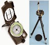
 مفهوم واستخدامات البوصلة المنشورية عرف البوصلة علي قياس انحرافات اتجاهات الاهداف علي سطح الارض عن اتجاه الشمال المغناطيسي حيث انه اذا و...
 -
 الترافرس المساحي انشاء المضلعات الترافرس Traverse يلجأ عمليات المسح التفصيلي ورسم الخرائط كبيرة المقياس الي انشاء مضلعات تصل بين نقاط ...