
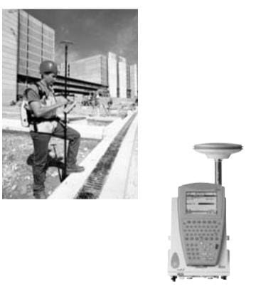
GPS surveys use the signals transmitted by satellites having trajectories such that any point on the Earth's surface can be determined around the clock and independently of weather conditions. The positioning accuracy depends on the type of GPS receiver and on the observation and post- processing techniques used.
Compared with the use of a total station, GPS surveying offers the advantage that the points to be mutually visible. Today, provided that the sky is relatively unobstructed (by trees, buildings etc,) and there- fore that adequate satellite signals can be received, GPS equipment can be applied to many survey tasks that until recently were carried out using electronic total stations.


0 تعليقات
اذا كنت خارج البلاد ومحتاج معلومة مهمة ومش لاقيها ! ممكن دلوقتي تكتب نوع المعلومة الي انت محتاجها وراح نجاوبك بيها علي طول من خلال اضافتها للموقع او من خلال الرد عليك من خلال بريدك الالكتروني او الاتصال بك مباشرة
(أطلب الشرح الي انت محتاجة ولا تتردد)
فريق منارة العلوم يساعدك علي مدار 24 ساعة